Using Open Data, Data Journalism, and Storytelling For Social Good in Nairobi
This post is part of our series on the Open Heroines Community Events Fund to support local or international OH meetups on gender and the intersection of data/open government/civic tech.
It was written by Laura Mugeha. Laura is a GIS analyst and developer based in Nairobi, Kenya. She is Regional Ambassador for YouthMappers and builds OpenStreetMap Kenya.
Every year around the world, open data communities gather to celebrate the annual Open Data Day in March. With this year’s theme being open data for equal development, we hosted a local event in Nairobi, Kenya, on the 7th of March 2020 with a group of YouthMappers, open data enthusiasts, OpenStreetMap contributors, and users. This was the second time after a successful event in 2019.
Our event was mainly focused on open geospatial data, open mapping, and how we can use this data to highlight and solve various societal challenges.
What is open geospatial data?
First, we had a quick discussion on what open data and open geospatial data is. From the descriptions shared by our attendees, we agreed that similar to open data, open geospatial data refers to location-based data that anyone can freely access, use, reuse, and share with no restrictions.
This includes both vector data: planimetric features such as buildings, roads, points of interest (locations of facilities: hospitals, schools, shops, etc.) and raster data: satellite imagery.
Open geospatial data is vital because all problems are located somewhere; therefore, all sustainable solutions must be location-specific.
Using examples, we further explored the four essential concepts for open data. These included:
- Findability and accessibility: These datasets should be made available online on the web in a machine-readable format. One can now easily access data through local open data platforms such as the Kenya Open Data Portal, regional ones like the Africa Geoportal, and global platforms like Open Aerial Map.
- Interoperability: Open data should be made available in a standard understandable format. This would allow any user to quickly edit, analyze, and merge this data with other necessary datasets. For this case, we highlighted the provision of datasets locally by the government and other African governments in PDF, making it harder for use as this format can not be directly analyzed and merged with other datasets. A typical example is the 2019 census data provided in PDF. To use this in a geospatial environment, one will need to manually match the numbers to administrative boundaries.
- Reusability: Open data should be licensed with an open license allowing its free use, including commercial purposes. A great example is OpenStreetMap licensed with an Open Database Licence (ODbL) published by Open Data Commons (ODC).
What is open mapping?
In comparison to open data, open mapping is a more collaborative and crowdsourcing initiative aimed at creating free and open geospatial data. In this case, quality data is generated by individuals and communities. The largest and most impactful open mapping initiative is the OpenStreetMap project, with over 6.5 million users contributing in different ways.
Are there any challenges of open geospatial data?
The main challenge discussed was the redistribution and sharing of open geospatial data, which has led to the creation of erroneous data in terms of wrong georeferencing, making it harder for quick use. Various users tend to use different coordinate systems for multiple purposes; hence, it is necessary to add descriptions of the methods used. Other challenges included notable gaps in the datasets and unclear data sources.
Without the data, the tools are useless; and without the software, the data is unmanageable.
To get insights from raw data by processing, editing, and visualization, we need accessible software with inbuilt tools and environments that will enable us to carry out these analyses. Therefore, there is a need for free and open-source software and collaboration between open data and FOSS communities. Like open data, one can freely access open source software and further modify the source code.
Open Data & FOSS = Open research = Open science
With freely available and accessible data and software, we can carry out scientific research and projects that are then usable for solving real-world problems. Both open data and FOSS enable citizen participation and innovation, therefore, linking governments, policymakers, businesses, and organizations.
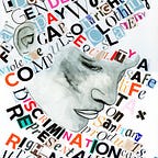
Turning open data into actionable information
We then had an insightful session by Ms. Naima Mungai, a project manager at Code For Africa. She extensively shared with us on open government data, data quality & privacy, and common myths and misconceptions of open data.
Additionally, by showcasing some of the impactful projects being done by Code For Africa across the continent, she explained to us how we could use open data and data journalism to highlight challenges that we encounter and create solutions to these problems.
To end the day, we had a map-a-thon to add AI-generated data into OpenStreetMap. We helped create accounts for new mappers and had a hand-on training session with the attendees. As the event coincided with the International Women’s Day, we worked on a task to create gender data. This is very important as there are considerable gaps in gender data meaning gender based issues are not highlighted or catered for when designing solutions.
We are very thankful to Code For Africa for sharing with us on open data, data journalism & storytelling, and their fascinating and impactful work across the continent. This was insightful, and we were all motivated to work on solutions to our societal problems.
Finally, we are grateful to Open Heroines and YouthMappers for their endless support in planning and organizing for this event! See you in 2021, hopefully in person :)
Follow Laura on Twitter for more on Geodata, Open Tech and Diversity.